 |
 |
 |
||||||||||||
 |
 |
 |
 |
 |
 |
 |
 |
|||||||
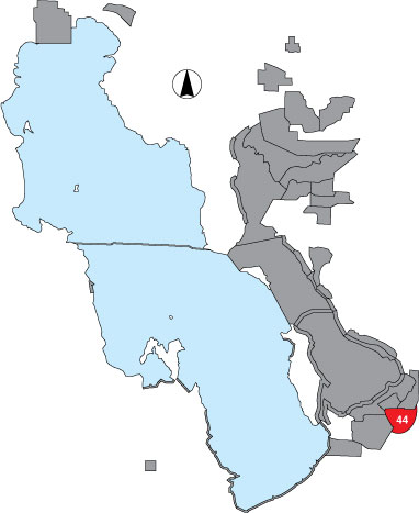
44 Jordan River
Description |
This area consists of agricultural land that can be flooded and used by waterbirds when lake elevations are high. Since the property is private, access is restricted. It was surveyed by transect from an airplane. |
Primary Habitat
Area Size (ha) |
290.7 |
Estimated Area Covered by Survey (ha) |
230.7 |
Years Surveyed |
2 |
Detection Rates |
It is difficult to count and identify birds while flying at speeds of 80+ mph. It is also very difficult to see small birds. Survey accuracy is moderate, as there are few birds. An observer counts out 1/8 mile on either side of the plane. This area was surveyed only every 3rd period, alternating with Stansbury Island North. |
Site Bird Data
|