 |
 |
 |
||||||||||||
 |
 |
 |
 |
 |
 |
 |
 |
|||||||
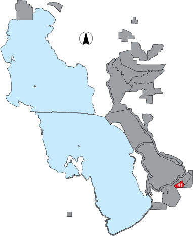
41 New State Duck Club
Description |
The area is within property boundaries of New State Inc., bounded by the outer dike on the north, the east channel, Margetts dike on the south and the Salt Lake City sewage canal on the west. A total count was made during travel on the canals, and at ponds along the route. |
Primary Habitat
Area Size (ha) |
1200.2 |
Estimated Area Covered by Survey (ha) |
600.1 |
Years Surveyed |
2 |
Detection Rates |
Visibility is not good. There is much emergent vegetation obstructing vision and some ponds are very large with difficult viewing distances. Counts from this area are very conservative. |
Site Bird Data
|