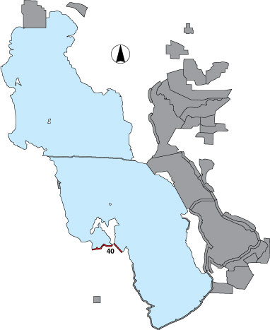
40 Magcorp

Description

This area runs along the Magcorp (currently called US Magnesium Corporation of Salt Lake City) dike road from the west GSL shoreline to Badger and Stansbury Islands. Pond 1N designates Magcorp’s solar pond “1 North.” It is the first pond to receive brine from the GSL and has approximately twice the salinity of the lake. The survey was conducted by driving the 11-mile length of the dike (western margin to Stansbury Island) and counting birds on the south side to the distance where species may be identified. Pond 0 designates the GSL immediately north of the Magcorp dike and is the source of water drawn into Magcorp’s solar ponds. Birds are counted on the north side along the length of the dike. There is no public access.

Primary Habitat

Salt Water  Fresh Water Saltwater Shorelines, Beaches and Playas Freshwater Shorelines Saltwater-Freshwater Interface Rocky Shorelines and Levees Freshwater Wetlands Salt Marsh Lakeside Uplands Wet Meadow & Flooded Pastures Riparian Systems Great Salt Lake Islands
X X

Area Size (ha)

752.0

Estimated Area Covered by Survey (ha)

752.0

Years Surveyed

4

Detection Rates

Visibility is generally good.

Site Bird Data

Species Mean Peak     Species Mean Peak
AGWT 0.4 1.8 GTBH 0.2 1.3
AMAV 2323.5 8908.0 KILL 0.4 3.0
AMCO 0.0 0.0 LBCU 1.8 7.3
AMWI 0.0 0.0 LBDO 0.0 0.0
AWPE 0.0 0.0 LESA 285.4 1180.8
BASA 0.0 14.3 LESC 0.9 2.3
BBPL 0.1 0.7 LEYE 0.0 0.0
BCNH 0.1 0.8 MAGO 0.0 7.7
BLTE 0.0 0.0 MALL 0.8 4.0
BNST 0.7 6.0 NOPI 0.0 0.0
BUFF 0.0 0.0 NSHO 0.0 0.0
BWTE 0.0 6.0 PBGR 0.0 0.0
CAEG 0.0 0.0 RBGU 0.0 0.0
CAGO 0.1 2.5 REDH 0.0 0.0
CAGU 2437.4 8174.0 RPHA 1258.9 2400.7
CANV 0.0 0.0 RUDU 0.8 2.0
CATE 0.0 0.0 SACR 0.0 0.0
CITE 0.5 2.7 SAND 12.9 50.0
CLGR 0.0 0.0 SNEG 0.0 0.0
COGO 0.0 0.0 SNPL 0.0 0.7
DCCO 0.0 0.0 SPSA 0.0 0.0
EAGR 376.6 1353.3 WEGR 1.3 10.0
FOTE 0.0 0.0 WESA 311.5 1078.0
FRGU 92.9 821.0 WFIB 1.0 5.0
GADW 0.7 4.7 WILL 0.1 3.3
GRYE 0.2 3.0 WIPH 36082.1 119789.0