 |
 |
 |
||||||||||||
 |
 |
 |
 |
 |
 |
 |
 |
|||||||
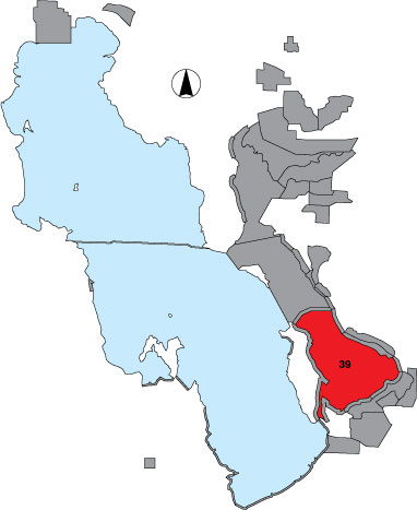
39 Farmington Bay Survey Area
Description |
We surveyed the open water area of the bay between the old Antelope Island causeway on the south and the new Antelope Island State Park causeway on the north. The survey was done from an airplane in east-west running transects spaced one mile apart. Observers counted birds on both sides of the plane out to 1/8 mile. To extrapolate to the whole area, transect counts were multiplied by four. The area has public access. |
Primary Habitat
Area Size (ha) |
28,716.6 |
Estimated Area Covered by Survey (ha) |
28,716.6 |
Years Surveyed |
5 |
Detection Rates |
It is difficult to count and identify birds while flying at speeds of 80+ mph. It is also very difficult to see small birds. Survey accuracy in this important area is not good. An observer counts out 1/8 mile on either side of the plane. During 1999-2001 this area was surveyed only every 3rd period, alternating with Stansbury Island North. |
Site Bird Data
|