 |
 |
 |
||||||||||||
 |
 |
 |
 |
 |
 |
 |
 |
|||||||
37 Bear River Bay
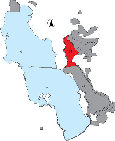
Description |
Bear River Bay in an open water area between the railroad causeway on the south and Bear River NWR on the north. It was surveyed from an airplane in east-west running transects spaced one mile apart. Observers counted birds on both sides of the plane out to 1/8 mile. To extrapolate to the whole area, transect counts were multiplied by four. Public access. |
Primary Habitat
Area Size (ha) |
16467.3 |
Estimated Area Covered by Survey (ha) |
16467.3 |
Years Surveyed |
5 |
Detection Rates |
It is difficult to count and identify birds while flying at speeds of 80+ mph. It is also very difficult to see small birds. Survey accuracy in this area is not good. |
Site Bird Data
|