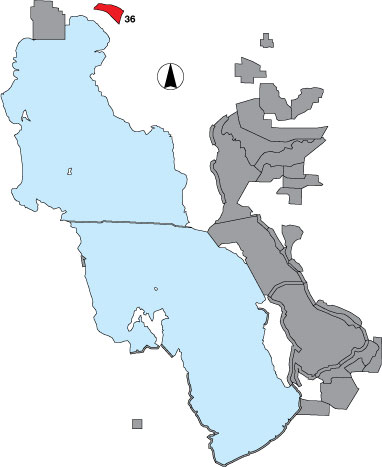
36 Salt Wells Flat WHA

Description

The survey area includes all established management units and outflow areas that are a part of Salt Wells Flat WHA. Managed by BLM.

Primary Habitat

Salt Water  Fresh Water Saltwater Shorelines, Beaches and Playas Freshwater Shorelines Saltwater-Freshwater Interface Rocky Shorelines and Levees Freshwater Wetlands Salt Marsh Lakeside Uplands Wet Meadow & Flooded Pastures Riparian Systems Great Salt Lake Islands
X X

Area Size (ha)

1659.8

Estimated Area Covered by Survey (ha)

663.9

Years Surveyed

5

Detection Rates

Visibility on the open mud flats is 100%. At the ponds tall, emergent vegetation blocked visibility—could only see 65%. Access is good and visibility could be increased from an observation tower. Mud is very soft so it is difficult to walk out into the area.

Site Bird Data

Species Mean Peak     Species Mean Peak
AGWT 6.0 35.5 GTBH 1.2 4.0
AMAV 16.1 318.0 KILL 9.5 20.0
AMCO 0.0 13.5 LBCU 10.7 19.8
AMWI 0.5 4.0 LBDO 1.7 151.0
AWPE 0.2 9.5 LESA 0.4 2.0
BASA 1.2 25.0 LESC 1.8 4.0
BBPL 0.2 0.5 LEYE 0.9 8.0
BCNH 0.1 1.0 MAGO 0.0 2.0
BLTE 0.0 6.0 MALL 4.2 67.0
BNST 8.0 98.0 NOPI 6.9 62.8
BUFF 0.5 1.5 NSHO 1.6 327.0
BWTE 1.4 35.0 PBGR 0.0 0.3
CAEG 0.0 0.0 RBGU 0.0 10.0
CAGO 5.4 18.0 REDH 1.5 14.5
CAGU 164.8 1715.3 RPHA 0.0 49.0
CANV 0.6 3.0 RUDU 0.6 3.0
CATE 0.0 0.5 SACR 0.3 2.0
CITE 5.6 60.0 SAND 0.0 0.0
CLGR 0.0 0.0 SNEG 0.2 0.7
COGO 0.8 4.0 SNPL 72.2 140.3
DCCO 0.0 0.0 SPSA 0.1 0.5
EAGR 0.3 1.0 WEGR 0.0 0.0
FOTE 0.0 0.0 WESA 24.3 73.0
FRGU 0.4 31.5 WFIB 17.4 106.0
GADW 10.5 38.0 WILL 34.5 92.5
GRYE 1.7 12.0 WIPH 21.8 119.5