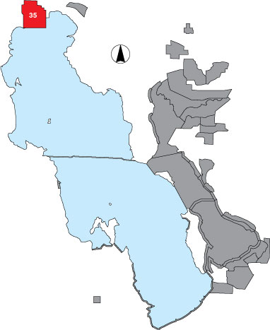
35 Locomotive Springs WMA

Description

The survey area includes all established management units and outflow areas that are a part of Locomotive Springs WMA. It is managed by UDWR.

Primary Habitat

Salt Water  Fresh Water Saltwater Shorelines, Beaches and Playas Freshwater Shorelines Saltwater-Freshwater Interface Rocky Shorelines and Levees Freshwater Wetlands Salt Marsh Lakeside Uplands Wet Meadow & Flooded Pastures Riparian Systems Great Salt Lake Islands
X X X

Area Size (ha)

7607.9

Estimated Area Covered by Survey (ha)

304.3

Years Surveyed

2

Detection Rates

Approximately 80% of this area has good visibility. Some marshy areas are inaccessible, and some large ponds are difficult to see across from the dike. Of 20,000 acres, 4% was covered by survey, and 17% is good waterbird habitat. The mudflat is where snowy plovers have been observed in large numbers in other studies, but were not surveyed here.

Site Bird Data

Species Mean Peak     Species Mean Peak
AGWT 114.0 437.0 GTBH 8.9 12.5
AMAV 20.2 343.0 KILL 15.2 73.0
AMCO 9.2 755.0 LBCU 15.8 55.0
AMWI 15.4 560.0 LBDO 5.8 188.0
AWPE 5.4 129.0 LESA 0.0 0.0
BASA 1.8 11.0 LESC 36.0 120.0
BBPL 7.0 29.0 LEYE 4.9 23.5
BCNH 4.4 21.0 MAGO 3.5 17.5
BLTE 0.5 3.0 MALL 194.5 260.0
BNST 13.1 193.0 NOPI 217.3 366.0
BUFF 7.8 22.0 NSHO 27.1 169.0
BWTE 2.7 22.0 PBGR 2.0 6.0
CAEG 0.0 0.5 RBGU 4.5 16.0
CAGO 10.7 90.0 REDH 156.1 927.5
CAGU 33.3 133.0 RPHA 14.3 48.0
CANV 23.6 530.5 RUDU 8.2 21.0
CATE 2.2 8.0 SACR 0.7 4.0
CITE 27.5 314.0 SAND 0.2 46.5
CLGR 0.0 0.0 SNEG 1.6 4.0
COGO 0.0 0.0 SNPL 59.5 130.0
DCCO 6.0 35.0 SPSA 1.5 4.5
EAGR 0.6 4.0 WEGR 0.5 3.0
FOTE 10.8 42.0 WESA 62.1 120.0
FRGU 0.3 48.0 WFIB 54.8 110.5
GADW 24.6 262.0 WILL 76.3 170.0
GRYE 3.9 11.0 WIPH 117.4 272.0