 |
 |
 |
||||||||||||
 |
 |
 |
 |
 |
 |
 |
 |
|||||||
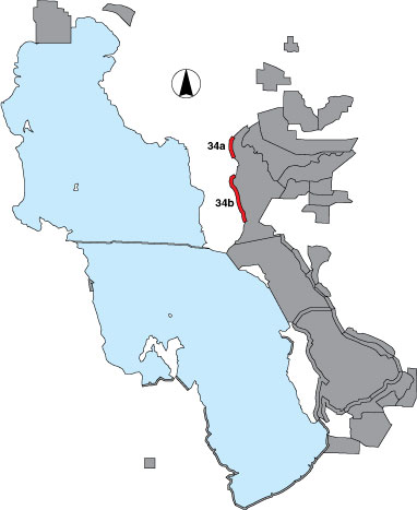
34 East Promontory
Description |
The eastern shore of the Promontory peninsula is surveyed between the UDWR waterfowl hunter access road and Pokes Point where the GSL Minerals Company dike access road still exists. The area is surveyed in two parts divided by the Booth Valley Hill. The northern part (34a) has three point samples, two of them located in drainages (access to shoreline through private property); the southern part (34b) is surveyed from the road (public access) that parallels the shoreline. |
Primary Habitat
Area Size (ha) |
34a = 425.8 34b = 1062.1 |
Estimated Area Covered by Survey (ha) |
34a = 425.8 34b = 1062.1 |
Years Surveyed |
5 |
Detection Rates |
It is not possible to see around Booth Valley Hill, and the north side of Booth Bay is too far from the road for accurate species identification and counting. A few other spots along the driving portion of the survey are difficult to see and may hide small numbers of birds. |
Site Bird Data (34a)
|
Site Bird Data (34b)
|