 |
 |
 |
||||||||||||
 |
 |
 |
 |
 |
 |
 |
 |
|||||||
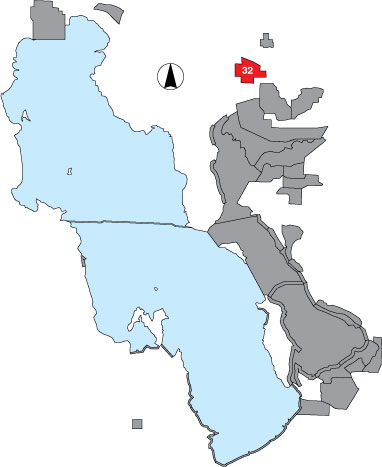
32 Public Shooting Grounds WMA
Description |
The area includes all accessible sites within the Public Shooting Grounds WMA with emphasis on the impoundments. An area count is included. It is managed by UDWR. |
Primary Habitat
Area Size (ha) |
3248.7 |
Estimated Area Covered by Survey (ha) |
649.7 |
Years Surveyed |
5 |
Detection Rates |
Detection rate for shorebirds is 100% -- mostly avocets and stilts. There is a large expanse of potholes that is not visible from the dike roads and probably hides waterfowl and other waterbirds. |
Site Bird Data
|