 |
 |
 |
||||||||||||
 |
 |
 |
 |
 |
 |
 |
 |
|||||||
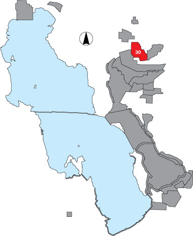
30 Bear River Club
Description |
Bear River Club is a total count survey including the area north of the Bear River access road, west of the road connecting Goose Island, and east of Public Shooting Grounds WMA. This area is private property. |
Primary Habitat
Area Size (ha) |
5183.8 |
Estimated Area Covered by Survey (ha) |
2073.5 |
Years Surveyed |
5 |
Detection Rates |
It is likely that emergent vegetation inhibits visibility in some places. |
Site Bird Data
|