 |
 |
 |
||||||||||||
 |
 |
 |
 |
 |
 |
 |
 |
|||||||
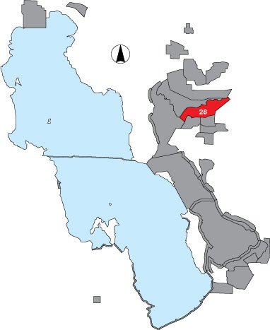
28 Willard Spur
Description |
This area is bounded by emergent marsh or sandbar fringe on the north, the Willard Bay reservoir dike on the east, the North Harold Crane dike and emergent marsh on the south, and a line from the northwest corner of GSL Minerals Company north to the mud bar spit on the west. It is surveyed from an airplane in four transects running in an east-west orientation. In 1997, this area was surveyed on the ground by airboat. The area is managed by USFWS. |
Primary Habitat
Area Size (ha) |
6590.3 |
Estimated Area Covered by Survey (ha) |
6590.3 |
Years Surveyed |
5 |
Detection Rates |
Because this area is rich in numbers and diversity of species, it is difficult to count and identify birds while flying at speeds of 80+ mph. It is also very difficult to see small birds. Survey accuracy in this important area is not good. An observer counts out 1/8 mile on either side of the plane. Four transects were surveyed and data were extrapolated to reflect total coverage. Due to high variability in habitat types within each transect, this extrapolation is not a good technique. The true birds/ha is most likely much greater that the data listed here. |
Site Bird Data
|