 |
 |
 |
||||||||||||
 |
 |
 |
 |
 |
 |
 |
 |
|||||||
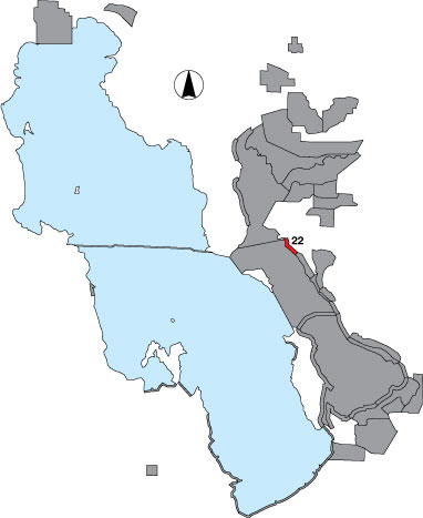
22 Ogden Bay North
Description |
This is a shoreline piece from the north fork of the Weber River to the railroad tracks surveyed from an airboat. Counts do not include gulls, etc., that are directly associated with Landing Rocks. The area has public access. |
Primary Habitat
Area Size (ha) |
389.4 |
Estimated Area Covered by Survey (ha) |
389.4 |
Years Surveyed |
4 |
Detection Rates |
Visibility is clear. The mudflat is only viewed from the airboat. Often snowy plovers and small sandpipers are viewed along the water edge. However, the more inland parts of the mudflat are not searched so snowy plover numbers are likely very conservative. Also, it can be difficult to separate flocks for counting when the airboat causes birds to flush and blend with others farther down the route. |
Site Bird Data
|