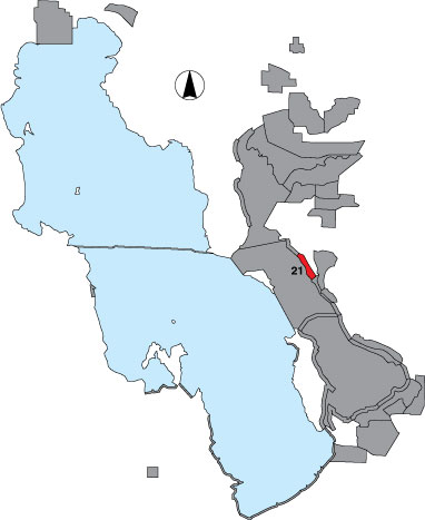
21 Ogden Bay Lakeside

Description

This area is surveyed by airboat as a total count and includes the Pintail Flats portion of Ogden Bay WMA between the north and south forks of the Weber River.

Primary Habitat

Salt Water  Fresh Water Saltwater Shorelines, Beaches and Playas Freshwater Shorelines Saltwater-Freshwater Interface Rocky Shorelines and Levees Freshwater Wetlands Salt Marsh Lakeside Uplands Wet Meadow & Flooded Pastures Riparian Systems Great Salt Lake Islands
X X

Area Size (ha)

811.4

Estimated Area Covered by Survey (ha)

649.1

Years Surveyed

5

Detection Rates

The easternmost part of the area is covered with emergent vegetation and not all birds are detectable. The noise of the airboat flushes many birds, but it is likely that many hide in the vegetation. Further west visibility is good, but it can be difficult to separate flocks for counting when the airboat causes birds to flush, blending in with other groups farther down the route. Also, flock sizes can be very large and the viewing perspective from the airboat when birds are clumped on the ground isn’t as favorable as an aerial view might be. Accordingly, counts may be skewed.

Site Bird Data

Species Mean Peak     Species Mean Peak
AGWT 969.8 2058.2 GTBH 2.8 6.8
AMAV 4858.5 11414.0 KILL 0.6 6.3
AMCO 5.4 165.0 LBCU 10.8 86.5
AMWI 52.5 142.0 LBDO 37.2 1554.8
AWPE 6.8 68.0 LESA 8.2 123.3
BASA 1.4 5.8 LESC 1.5 7.3
BBPL 82.2 239.0 LEYE 0.9 8.8
BCNH 2.1 7.0 MAGO 4.9 114.0
BLTE 2.1 8.4 MALL 27.9 215.8
BNST 758.2 1996.4 NOPI 132.8 1200.5
BUFF 0.0 0.0 NSHO 1023.8 3083.4
BWTE 0.4 3.8 PBGR 0.0 0.0
CAEG 0.9 6.0 RBGU 507.3 883.8
CAGO 13.1 41.0 REDH 9.5 104.8
CAGU 3057.9 9416.2 RPHA 1010.6 4016.8
CANV 0.0 0.0 RUDU 2.7 12.0
CATE 0.7 7.6 SACR 0.5 2.0
CITE 32.2 250.3 SAND 451.0 2093.8
CLGR 0.0 0.0 SNEG 20.3 43.0
COGO 0.1 0.3 SNPL 0.4 6.4
DCCO 4.8 12.2 SPSA 0.2 1.0
EAGR 4.4 338.5 WEGR 0.1 0.8
FOTE 18.2 55.0 WESA 985.9 5739.0
FRGU 4834.9 11203.2 WFIB 224.2 651.0
GADW 20.4 199.5 WILL 254.1 396.5
GRYE 0.5 4.4 WIPH 32876.9 69469.4