Description
|
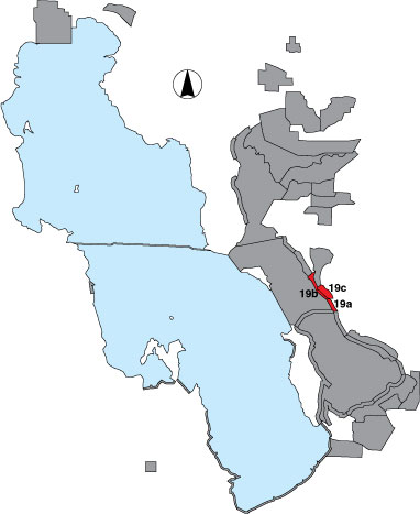
Howard Slough WMA consists of three sections: shoreline, dike, and ponds. The shoreline section (19a) extends between the northern Antelope Island causeway and the southernmost Howard Slough WMA dike. It includes two point samples. In 1997, one point was designated in a drainage and the other randomly selected. During the following four years both points were classified as randomly selected. The dike section (19b) is a total count survey of a section of Great Salt Lake shoreline west of the WMA dikes. It is bounded between the north end of 19a and the south fork of the Weber River on the Ogden Bay WMA. The pond section (19c) is an area count and consists of the drivable impoundments in Howard Slough WMA. This section was included as part of the Ogden Bay WMA survey in 1997. |


