 |
 |
 |
||||||||||||
 |
 |
 |
 |
 |
 |
 |
 |
|||||||
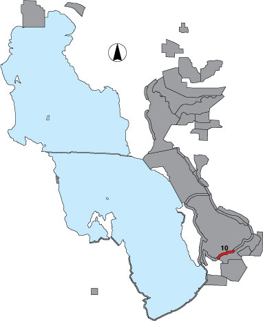
10 Crystal Lakeside
Description |
The Crystal Lakeside site includes area from the southernmost major drainage on the Crystal Unit of Farmington Bay WMA to the southwest elbow of the Turpin dike. This survey is a total count done from an airboat via a public access boat ramp in Farmington Bay WMA. |
Primary Habitat
Area Size (ha) |
786.1 |
Estimated Area Covered by Survey (ha) |
786.1 |
Years Surveyed |
5 |
Detection Rates |
Emergent vegetation may obscure visibility in some areas. |
Site Bird Data
|