 |
 |
 |
||||||||||||
 |
 |
 |
 |
 |
 |
 |
 |
|||||||
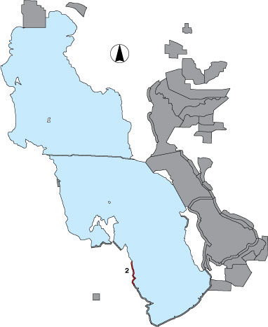
2 Stansbury Island North
Description |
Facing east, this narrow, privately owned, shoreline runs from the north tip of Stansbury Island to the pumping station gate at the south end. Because land access was denied the survey was not completed in 1997 or 1998. In 1999, the shoreline stretch was included as an aerial survey alternating with the Farmington Bay aerial survey every third period. |
Primary Habitat
Area Size (ha) |
785.6 |
Estimated Area Covered by Survey (ha) |
785.6 |
Years Surveyed |
3 |
Detection Rates |
Visibility is not obstructed, but rapid travel by airplane can make counting and identification difficult. However, because total numbers were always generally low in this area, it is likely counts are reliable. |
Site Bird Data
|